
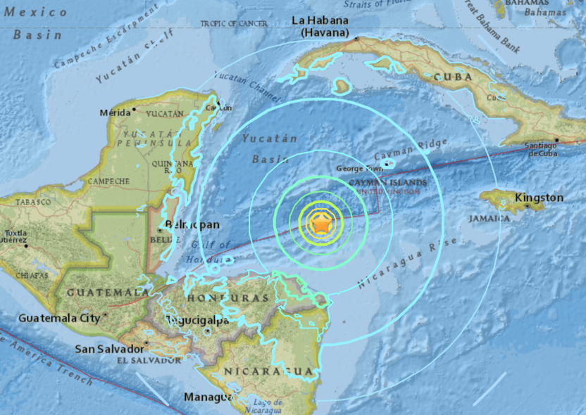
The US Geological Survey (USGS) reported a powerful 7.7 magnitude earthquake on the northwest coast of Jamaica. The quake hit between Jamaica, the Cayman Islands and Cuba at a depth of 6.2 miles. It struck about 70 miles northwest of Montego Bay, Jamaica, shortly after 2 p.m. on Tuesday. The tremor was also felt in Mexico, Florida and further east in Cuba, including the US Navy base Guantanamo Bay. Several buildings were evacuated in Miami. The first tremor was followed by several strong aftershocks, including a magnitude 6.1 tremor about 35 miles southeast of the Cayman Islands.
The epicentre of the earthquake was 125 km north-west of Lucea, Jamaica. It was initially reported as a magnitude 7.3 before being upgraded. The centre of the earthquake was a relatively shallow six miles beneath the surface of the ocean. prompting fears of a tsunami.
The US Tsunami Warning Centre issued a brief tsunami warning and alert for Jamaica, Cuba and the Cayman Islands. The Pacific Tsunami Warning Center (PTWC) initially warned that tsunami waves of up to three feet were possible for coasts located within 186 miles of the epicentre, including parts of Belize, Cuba, Honduras, Mexico, the Cayman Islands and Jamaica. Later, at around 20:45 GMT, the PTWC withdrew the warnings and said that the “tsunami threat had now largely passed”. In the Cayman Islands at George Town, a tsunami of 0.4 feet was recorded. Since the earthquake was largely caused by a strike-slip mechanism with some obliquity, it did not result in a larger tsunami.
Though some offices were temporarily evacuated in Miami and parts of Jamaica, there have been no reports of causalities or serious damage. The quake appears to be one of the strongest earthquakes on record in the Caribbean and the largest since 1946. It took place only three weeks after a 6.4 magnitude earthquake struck Puerto Rico.
Image Source: The Gate